Why The Pennine Way?
Several folks have asked me why I am traveling all the way to England to hike when I live in the Yukon. A couple of reasons:
- I learned about the Pennine Way when I went to university in Nottingham, and vowed someday I would hike it.
- The Yukon is harsh, especially for a solo hiker who can encounter harsh weather, bear, extreme river crossings, and unmarked trails. For me, the Pennine Way is much tamer as I’ll be hiking on an established trail and do not have to worry about bear or river crossings. For the most part, the trail will be marked, but some sections may not be. Regarding the weather, I may encounter warm days or days of rain and wind. I’ve been following the Pennine Way Walkers FB group — and to be honest, I’m not sure what to expect other than an adventure. I’ll be thinking of Greg the entire time.
Pennine Way – Pre-Trip Planning
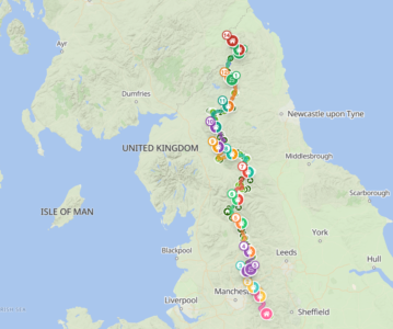
- The anticipated trail. This trail is just an outline of what I plan to do. Who knows what will happen on the trail. Some of my days are ambitious with 20-25 (30-41km) mile hikes. I’ll be headed North– leaving from Edale.
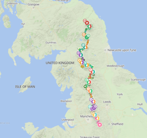
- Here’s my anticipated hiking schedule.
- Here’s my packing list.
GPX Files by Day
- June 2 – Day 1
- June 3 – Day 2
- June 4 – Day 3
- June 5 – Day 4
- June 6 – Day 5
- June 7 – Day 6
- June 8 – Day 7
- June 9 – Day 8
- June 10 – Day 9
- June 11 – Day 10
- June 12 – Day 11
- June 13 – Day 12
- June 14 – Day 13
- June 15 – Day 14
Follow Me On Strava
I’m going to try to track my hike using Strava. If you don’t have Strava and want to follow along, you should be able to join for free and see my tracks at the end of the day. Or, try following me on PolarSteps — I’ve never used this before so I’m not sure if it will work, but you’ll need to sign up for a free account to follow me.